Details
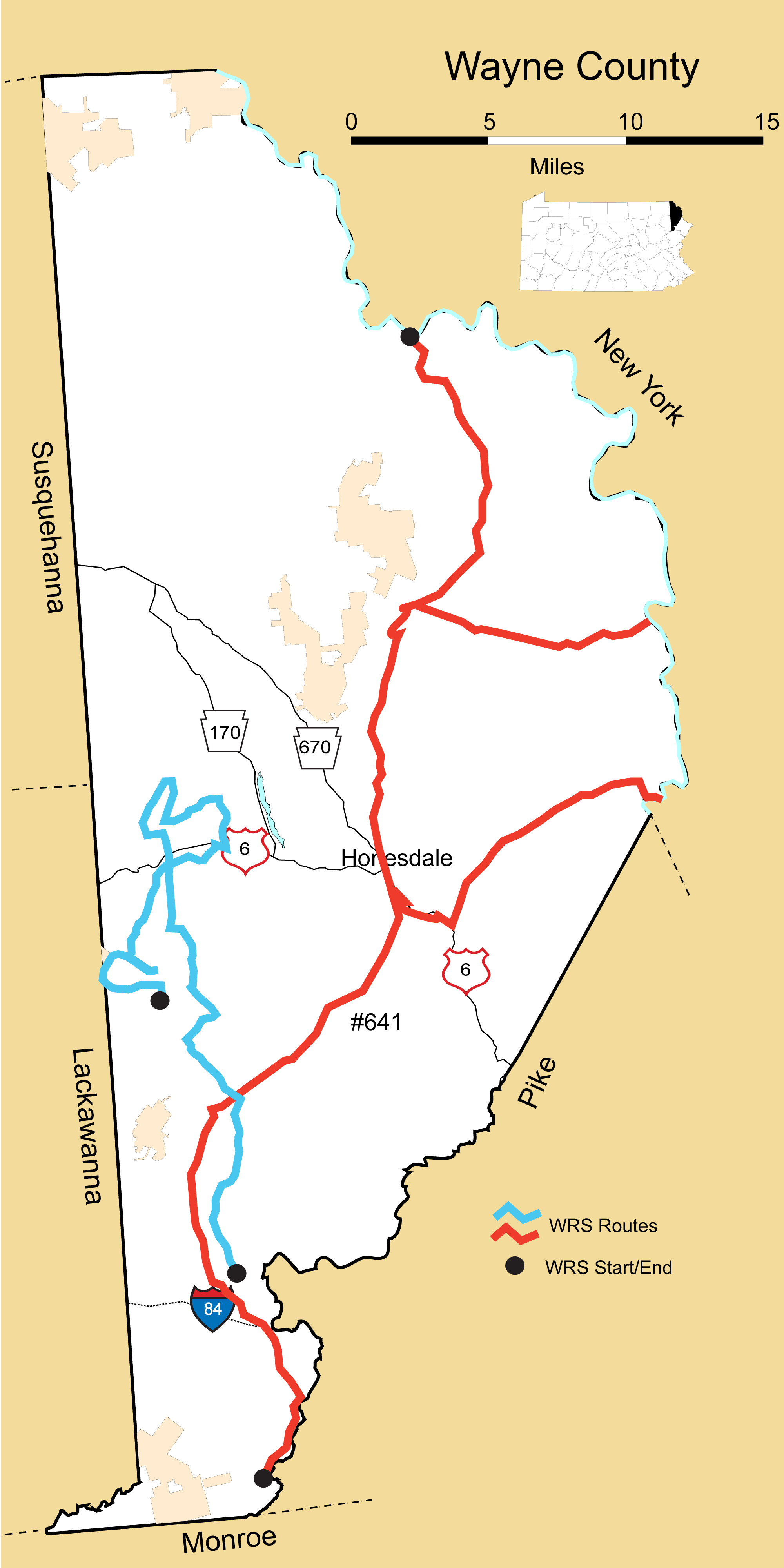
Route#: 641
Route Name: S&E Wayne
Compiler:
Directions: PA 191 North from Lackawanna Co. Line to Delaware River
NY State border
Sometimes survey PA 652 and PA 371
Route#: 642
Route Name: Western Wayne County
Compiler: Ryan Johnson
Directions: START: Intersection of Uban Road & Bidwell Hill Road in Salem Township, Wayne County, PA
Travel North on Bidwell Hill Road (SR 3005) for approx. 3.44 miles. Continue straight onto Golf Park Drive (SR 3011).
Travel North on Golf Park Drive (SR 3011) for approx. 3.84 miles. Continue straight onto Stock Farm Road (T376) for approx. .5 miles. Follow the road to the left onto Tisdel Road for approx. 1.3 miles until its junction with PA Route 296.
Continue straight onto PA Route 296 for approx. 1.72 miles. Make a right onto Hemlock Road.
Travel Northeast on Hemlock Road for approx. 1.5 miles. Make a left onto South Baker Road (T412).
Travel Northwest on South Baker Road (T412) for approx. 1.4 miles. Make a right onto St. Tikhons Road (SR 3018) followed by an immediate left onto North Baker Road (T412).
Travel North on North Baker Road (T412) for approx. 2.6 miles. Make a right onto PA Route 296.
Continue North on PA Route 296 for approx. 2.36 miles. Make a right onto Honesdale Road.
Continue East on Honesdale Road for approx. 2 miles. Make a left onto Little Keen Road followed quickly by a right onto US Route 6. Continue straight on Route 6 for .4 miles. Make a left onto Elk Lake (SR 4001).
Travel North on Elk Lake Drive (SR 4001) for approx. 1.95 miles. Make a left onto Stanton Drive (SR 4002).
Travel Southwest on Stanton Drive (SR 4002) for approx. 2.25 miles. Make a right onto PA 296. Continue on 296 for approx. 1.54 miles, then make a left onto Cirelly Road.
Continue on Cirelly Road for approx. 0.2 miles until it ends, turn left onto South Smith Road.
Continue on South Smith Road for approx. 2.76 miles.
Continue South on PA 296 for approx. 1.13 miles. Make a right onto Carbondale Road (SR 3030).
Continue Southwest on Carbondale Road (SR 3030) for approx. .6 miles. Make a left onto Canaan Road.
Continue South on Canaan Road for approx. 1.91 miles. Make a left onto Township Road 424.
Continue south on Township Road 424 for approx. 1.28 miles. Make a left onto Township Road 439 (Robinson Road).
Continue East on Robinson Road (Twp. Rd. 439) for approx. 1.2 miles until its junction with PA 296.
Backtrack/return to the end of Township Road 424.
Continue straight on Robinson Road (Twp. Rd. 439) for approx. 1.5 miles. Make a left onto Salem Mountain Road (SR 1019).
Continue East on Salem Mountain Road (SR 1019) and Jubinsky Road (SR 3022) for approx. 2.3 miles. Make a right onto PA 296.
Continue South on PA 296 for approx. .6 miles.
END: South Canaan Township Municipal Building in South Canaan Township, Wayne County, PA
APPROXIMATE ROUTE DISTANCE: 38.44 Miles