Details
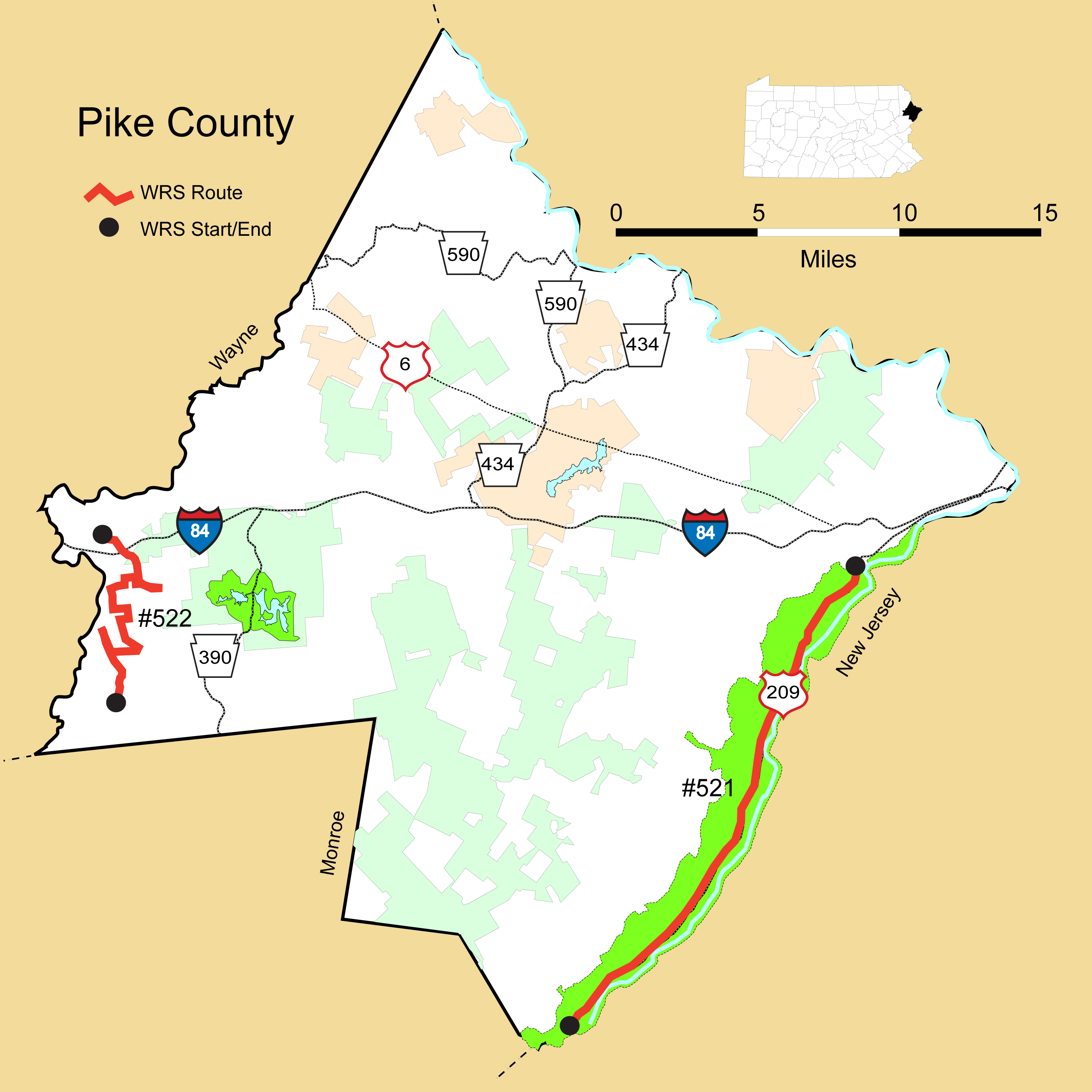
Route#: 521
Route Name: East Pike
Compiler: Jim Thomson
Directions: The WRS runs along US 209 thru the Delaware Water Gap Nat'l Recreation area.
We start at the intersection of US 209 and Bushkill Falls Road.
We continue north from there,staying on US 209 north the entire time into the
town of Milford, Pa. The WRS ends where Us 209 merges with US 6.
Route#: 522
Route Name: Western Pike County
Compiler: Ryan Johnson
Directions: Route Start:
Southeast of Newfoundland on Pine Grove Road at 41.263356, -75.303692 (near Russel's Way & Felton Lane).
Driving Directions:
1.) Continue North on Pine Grove Road for 0.6 miles; turn left onto PA-447.
2.) Continue on PA-447 for approx. 2.3 miles; turn around where Hemlock Grove Road (SR-3001) goes off to the right and begin backtracking; turn left onto Stony Lonesome Road.
3.) Continue on Stony Lonesome Road for approx. 1.06 miles; turn left onto Roemerville Road.
4.) Continue on Roemerville Road for approx. 1.27 miles; turn right onto Sawmill Road (TR-372).
5.) Continue on Sawmill Road (TR-372) for approx. 0.3 miles; turn left onto Valley View Road.
6.) Continue on Valley View Road for approx. 0.9 miles; turn right onto Hemlock Grove Road (SR-3001).
7.) Continue on Hemlock Grove Road (SR-3001) for approx. 0.7 miles; turn right onto Brink Hill Road.
8.) Continue on Brink Hill Road for approx. 1.15 miles; turn right onto Lake Paupack Road.
9.) Continue on Lake Paupack Road for approx. 1 mile; turn around and return to Brink Hill Road.
10.) Turn right onto Brink Hill Road & make the first left onto Beaverdam Road.
11.) Continue on Beaverdam Road for approx. 2 miles until it joins PA-507.
Route End:
Where Beaverdam Road meets PA-507