Details
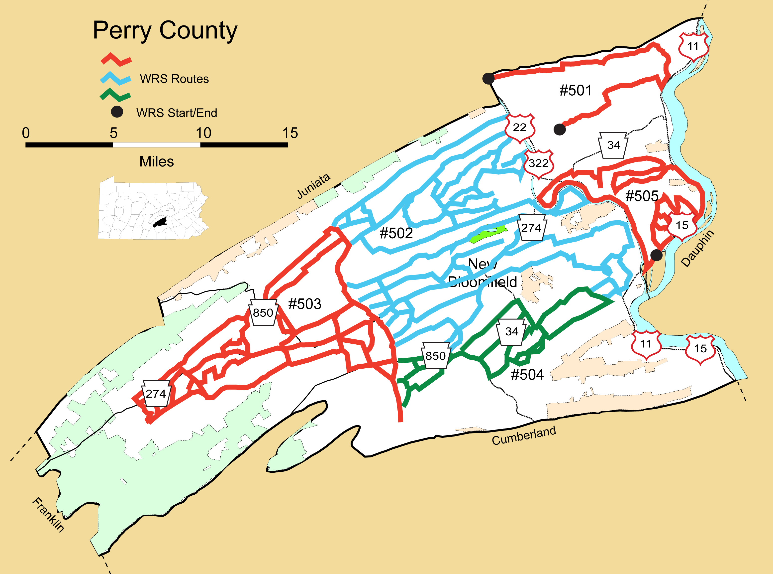
Route#: 501
Route Name: NE Perry
Compiler: Don Orris
Directions: Start at the intersection of Centerville and Hollow roads.
Go east on Perry Valley Road for 2.2 miles.
Turn left on Windy Hill Road and go 0.7 mile.
Turn right on Ridge Road and go 3.1 miles.
Turn right on PA 17 and go 0.7 mile.
Turn left on South Market Street and go 2.3 miles (Market Street becomes Riverview Road north of town).
Turn left on Fishing Rod Road and then immediately right on Barners Church Road and go 1.6 miles.
Go straight onto PA 235 and go 0.4 mile and continue left on Witmer Road.
Go 2.2 miles (Witmer Road becomes Valley View Road and then Butcher Hollow Road).
Turn right on Nekoda Road and go 2.4 miles.
Turn left on Seven Stars Road and go 0.3 mile.
Turn right on Pfoutz Valley Road and go 3.9 miles.
Bear right on Persimmon Drive and go 0.5 mile to the county line and end of route.
Route#: 502
Route Name: Perry NE
Compiler: Kim Van Fleet
Directions: No written directions submitted
Route#: 503
Route Name: Perry West
Compiler: Kim Van Fleet
Directions: No written directions submitted
Route#: 504
Route Name: Perry SE
Compiler: Kim Van Fleet
Directions: No written directions submitted
Route#: 505
Route Name: Perry East
Compiler: Tiffany Willow
Directions: Start at The Liberty Travel (Exxon)
LEFT onto Old Trail Rd. for .5 mile
RIGHT onto 11/15(S) for .5 mile
RIGHT onto Taylor Rd for .7 mile
RIGHT onto Amity Rd for 1.5 mile
RIGHT onto Huggins Rd for .2 mile
RIGHT onto Blacksnake Rd for .7 mile
RIGHT onto Circle Rd for .4 mile
RIGHT onto Amity Rd for 1.1 mile (a small portion to Huggins Rd is a repeat)
RIGHT onto Notch Rd for .6 mile
RIGHT to stay on Notch Rd for .2 mile
RIGHT onto Spinning Wheel Rd for 1.1 mile
LEFT onto Buffalo Creek Rd for .8 mile
RIGHT onto Motter Rd for 1.8 mile
LEFT onto 11/15 N for 4 miles
LEFT onto Bucks Valley Rd for .3 mile
LEFT onto Meadow Grove Rd for 3.7 miles
RIGHT onto Chicken Hollow Rd for 1 mile
RIGHT onto Center Rd for 3 miles
LEFT onto Bucks Valley Rd for 4.5 miles
LEFT onto Acker Loop Rd for .4 mile
RIGHT onto Acker Rd for .7 mile
Turn around at Shadewood (is this a good place to get out and scan?) head back to
LEFT onto Bucks Valley Rd for 1.8 mile (Acker rd and a small portion of Bucks Valley
to Acker loop is a repeat)
LEFT onto Red Hill Rd for 2.5 miles
LEFT onto E. Juniata Pkwy for 5.5 miles
Ramp to 22/322 for 4.4 miles
Exit to 11/15 N toward Selinsgrove .5 mile
LEFT onto River Rd for .5 mile (to Public Boat Launch) & Turn around
LEFT at end of River Rd. toward 11/15(N) Selinsgrove for 2 miles
End at The Liberty Travel (Exxon)