Details
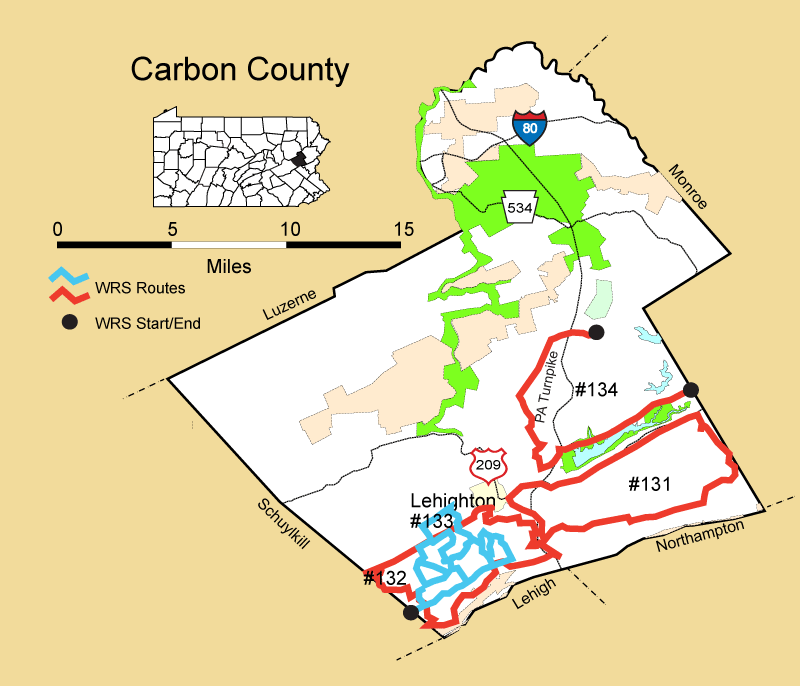
Route#: 131
Route Name: SE Carbon
Compiler: Rick Gaeta
Directions: No written directions submitted
West Boundary - Lehigh River, PA 248, and PA 209
South Boundary Blue Mountain
East Boundary - Monroe County Line
North Boundary - Monroe County Line
Route#: 132
Route Name: SW Carbon
Compiler: Rick Gaeta
Directions: No written directions submitted
West Boundary - Schuylkill Co. Line
South Boundary - Blue Mountain Appalachian Trail
East Boundary - Lehigh River - Route 248
North Boundary - Route 443
Route#:
Route Name:
Compiler:
Directions:
Route#: 134
Route Name: NW Carbon
Compiler: Claus Herrmann
Directions: Start at the Monroe/Carbon County line on Pohopoco Drive
Go west through the park.
Stop at the many small parking lots along the way that afford views of the both cultivated and fallow fields that surround Beltzville Lake.
Turn left into the boat launch area (Deer Lane) and again scan the surrounding fields and woodland edges.
After circling around the parking lot continue out back to Pohopoco Drive
Turn left, west.
Proceed to the next large entrance on left, the beach and Environmental Ed Center areas.
Cruise the large parking areas were once again a view of fields, woodland edges and the lake are possible.
Once complete, continue back out to Pohopoco Drive and again turn west, left.
Proceed to the PPL building, first drive in on left and get out and scan the dam and spillway areas.
Back out to Pohopoco Drive and again west, left.
Go approx 1 mile to small road on right, Grange Rd. It immediately crossed the NE Extension of the PA Turnpike (US 476), which is visible even before you turn right.
Proceed up to Fairlyland Rd. and make a left.
Continue 0.8 miles to Millers General Store. Their parking lot affords a safe place to scan the many fields spread out below towards Lehighton and the Turnpike.
Go back EAST (left) on Fairlyland Rd about 200 yds and make a left onto Overlook Drive. Follow approx 1 mile to stop sign.
Turn right onto Indian Hill Rd and proceed 0.7 miles onto Maury Rd.
Follow Maury Rd up the mountain to Penn's Peak.
Turn left into Penn's Peak parking lot and proceed all the way up to the highest south facing parking lot. Drive around the east side of the building toward the back and you can exit by the second driveway, to Maury Rd.
Turn Left (west) onto Maury Rd and follow to its intersection with PA 903.
Right on PA 903.
Follow PA 903 about 3 miles
Turn right on Reservoir Rd.
Follow Reservior Rd, checking the roadside, small fields and end at the power line cut 1.5 miles in.