| Lancaster Lebanon |
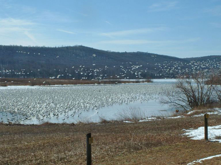
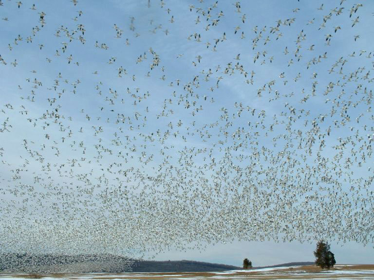
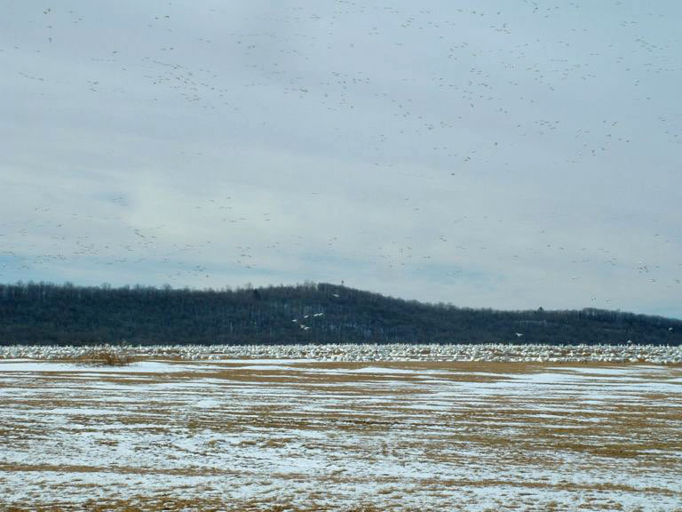
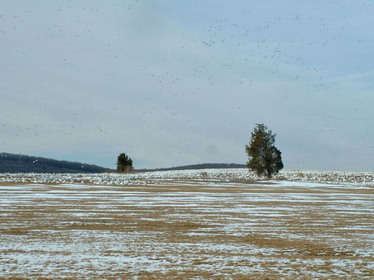
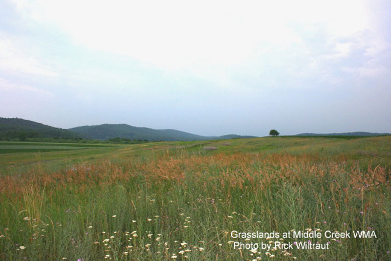
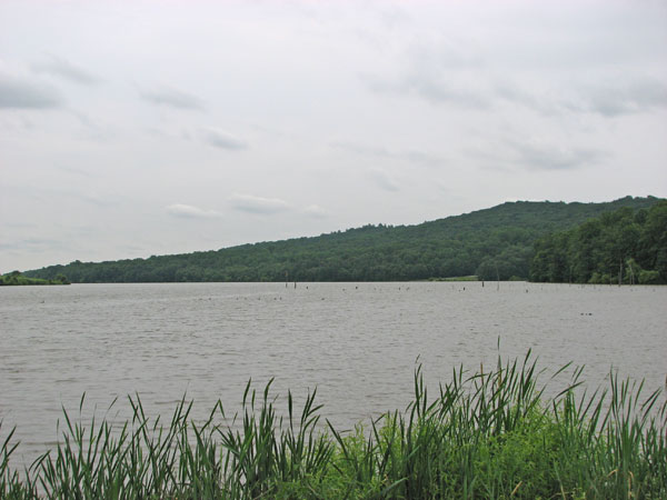
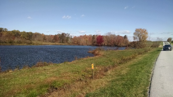
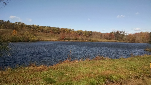
| DESCRIPTION: This area of slightly more than 5,000 acres is comprised of a 1,700-acre oak-hickory forested ridge, a 400-acre shallow lake, 70 acres of potholes, ponds and smaller impoundments, 1,300 acres of cultivated farmland, and several picnic areas, most of which have primitive toilet facilities. There are several small stands of cedars and pines along the wooded areas. There are several parking lots and a boat-launch area which provide opportunities to view the large lake. Most of the potholes, ponds, and impoundments can be viewed from the roads that cross through or border the area. There are eight hiking trails of varying difficulty that provide access to the wooded areas. A Visitors Center, including a small museum, is available to the public on a limited basis from March 1 through November 30. The center is open 8:00 a.m. to 4:00 p.m. Tuesday through Saturday; 12:00 noon to 5:00 p.m. on Sundays; and closed on Mondays. This building contains vending machines where light refreshments may be purchased and also houses modern rest room facilities. A bird checklist, a map, and brochures are available there. |
DIRECTIONS: From Lancaster--Travel north on PA 501 to its intersection with US 322 in Brickerville. Turn right and travel 2.6 miles to Clay. In Clay, turn left onto Clay Road (this will be the first road after crossing the bridge over Middle Creek). After traveling 1.1 miles, turn right at the "T" intersection in Hopeland onto Hopeland road. In 0.6 mile, Hopeland Road goes to the left; stay with Hopeland Road. (Straight ahead becomes Mt. Airy Road.) Continue on Hopeland Road from this intersection with Mt. Airy Road for 3.0 miles to Museum Road. Turn left on Museum Road. In 0.25 mile, this road ends at the Visitors Center and Museum. From the Pennsylvania Turnpike coming from the west--Use the Lebanon-Lancaster Exit (#266). Travel north on PA 72 for approximately 2.0 miles. Leave PA 72 at the exit marked "EPHRATA, US 322 EAST." Continue on US 322 to Brickerville where PA 501 intersects with US 322 and follow the directions listed in the previous section, continuing east on US 322. From the Pennsylvania Turnpike coming from the east--Use the Reading-Lancaster Exit (#286). Take the Turnpike Access Road to PA 272. Turn right onto PA 272 and travel north for 1.3 miles to the intersection with PA 897. Turn left onto PA 897 and travel west for 11.7 miles to the stop sign in Kleinfeltersville. From this stop sign, continue on PA 897 for 0.1 mile and turn left onto Hopeland Road. Turn right onto Museum Road to the Visitors Center (0.25 mile). Suggested Driving Route. Start at the Visitors Center. Return to Hopeland Road, turn left, and after rounding the curve park on the road shoulder. Check the lake on the right and the large pond and open field on the left. The lake is shallow here, and non-diving ducks are more likely to be seen nearby. Shorebirds are present in migration, their abundance dependent on water levels. From the starting point on Hopeland Road, travel 0.9 mile and turn right on the first road to the parking lot for Willow Point Trail. This trail, about 0.25 mile, leads to an observation point from which much of the 400-acre lake can be observed. While hiking this trail, check the brushy areas in all seasons for a variety of sparrows. This is one of the best sites in the state for finding Ross's Goose and Greater White-fronted Goose is found most years. It is not uncommon to find 25+ species of waterfowl on a good day during spring migration. Return to Hopeland Road, turn right, and in 0.1 mile turn right again. In summer, this is an excellent spot for Willow Flycatcher. Orchard and Baltimore orioles have been seen here. Raptors frequently observed in this area include Red-tailed Hawk and American Kestrel, with an occasional Red-shouldered Hawk. In 0.5 mile, turn right at the T intersection; traffic becomes one-way at this point. For the next mile the road passes through farmland that provides forage and cover for wildlife. Stop at the parking lot on the right for an excellent view into this side of the Propagation Area. This parking area (Stop 3) is referred to as the "Eagle Parking Lot" by local birders because, when Bald Eagle are present, they usually can be seen from here as they sit in the large dead trees along this edge of the lake. In summer the various grasslands along this road are good for Grasshopper Sparrow, Bobolink. Red-winged Blackbird, and Eastern Meadowlark. Sedge Wren and Dickcissel have nested. After traveling 1.0 mile from the T intersection, turn right. Check the grassy areas along the next 0.7 mile for Savannah and Grasshopper sparrows and Bobolink in spring, summer, and early fall. The impoundments on the right contain water only in the spring. This is a good place to check for shorebirds in spring migration and for puddle ducks. In a short distance after passing Girl Scout Road, two-way traffic begins here, there is a small picnic area on the right (no toilet facilities). In early spring the courtship flight of American Woodcock can be observed at dusk from this spot. From Girl Scout Road, travel 0.4 mile and turn left onto Shenk's Mill Road; travel 0.2 mile and turn left again. One-way traffic resumes at this point. Continue on this road for 0.7 mile. All traffic, and there may be traffic approaching from the opposite direction, must turn up the hill to the right. In one mile, this road intersects with PA 897. In spring, check the large pond on the left at the bottom of the hill for migrant waterfowl and, in late spring, for Green Heron and an occasional American or Least bittern along the brushy edges. Eastern Kingbird is very common along this road from mid-May through August. The larger pond on the right has been excellent over the years in spring migration for waterfowl. Shorebirds may also be found along the water's edge in spring and fall. The fields of longer grass can be good for Savannah and Grasshopper sparrows in spring, summer, and fall. Turn left on PA 897. Between here and Kleinfeltersville (2.2 miles) there are several places to stop to view the area or to take short hikes. In 0.3 mile, just after passing Stricklertown Road, there is a turn-off to the left to a small picnic area (no toilet facilities), from which a short walk along the hedgerows or through the small stands of pines may be taken only from February 1 to March 15. This area can be fairly productive for finches and sometimes for Hermit Thrush, Gray Catbird, and Eastern Towhee. The Multiflora Rose and brushy hedgerows can yield American Tree and Field sparrows. The stands of pines have, on occasion, served as a roosting area for Long-eared Owl. Return to PA 897 and turn left. In 0.4 mile, a small parking lot on the left provides views of small ponds and open fields. At 0.5 mile from this parking lot, turn left and park in the lot behind the small stone church, the Swamp Community Chapel. Scope the series of ponds that parallel PA 897. These ponds should be checked for waterfowl in all seasons. They can be good for shorebirds and waders in non-winter months. Return to PA 897, turn left, towards Kleinfeltersville. In 0.5 mile from the church there is a small pull off area on the left (not well-marked). From this vantage point you should scope the small ponds and mudflats for puddle ducks and shorebirds in migration. Red-shouldered Hawk can usually be found along the distant creek bottoms and adjacent fields. From this pull off continue towards Kleinfeltersville. From the stop sign, continue on PA 897 for 0.1 mile and turn left onto Hopeland Road. Continue on Hopeland Road for 2.3 miles to return to the starting point at Museum Road. During the controlled goose-hunting season (September 15 to the January closing date), access to the roads leading through the area is prohibited. The observer is limited to the roads on the edge of the area and the hiking trails in the wooded areas. Willow Point Trail is open only on days when there is no goose hunting. The lake may be viewed from the boat-launch area and along the east side of Hopeland Road. |
|
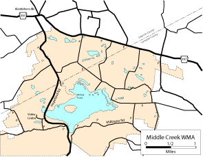
Maps - other than Google (Click on map for larger view)
|
|
Sub-sites |
Photos 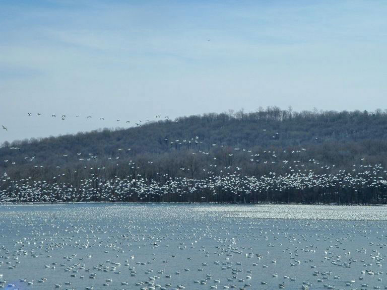
|
| Posted: 2009-10-24 00:00:00 Updated: |