| Forest |
| DESCRIPTION: This waterfowl management area under joint operation of the U.S. Forest Service and PGC is a good place for nesting waterfowl such as Canada Goose, American Black Duck, Mallard, and Blue-winged Teal. Many grassland-nesting birds, including Eastern Meadowlark, Bobolink, and various species of sparrows, are often present. Osprey are seen in migration. Northern Harrier is a visitor and a potential nester. Nesting boxes for Eastern Bluebird, Tree Swallow, and American Kestrel have increased the local populations of these species. Broad-winged Hawk, Yellow-bellied Sapsucker, Blue-headed Vireo, Hermit Thrush, and Northern Goshawk nest in the area. A variety of shorebirds stop in migration when any of the larger ponds are drawn down. The typical northern warblers can be found in the surrounding forest. |
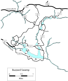
DIRECTIONS: To get to the south end, from Marienville on PA 66, go south on South Forest Road (SR 2005) for 1.23 miles and turn left (east) onto Buzzard Swamp Road. Go 2.25 miles to the parking area. You can walk a very rewarding 3.5-mile loop by taking FR 378 and turning left on FR 157 to return to the parking area. This takes you around the major ponds and some woods. Red-breasted Nuthatch, Brown Creeper, and northern warblers can be found along this loop. To get to the north side from Marienville on PA 66, turn east at the main intersection in Marienville onto Lamonaville Road. Lamonaville Road is the intersection just before the Uni-Mart. Don't turn sharply right, which will take you south toward Loleta. Drive 3.2 miles east on Lamonaville Road to the well-marked trailhead FR 377 on the right. You can park here or continue on for another mile (4.2 miles from Marienville) to the trailhead FR 157 on the right, or you can drive down FR 377 about a mile to another parking area and walk the trails from there. The following loop is 3.7 miles and starts at the FR 157 parking area. Walk south on Trail 157. The first part of the trail involves a 1.8 mile, well-marked, wide, grassy path that goes past several small fish-filled wooded lakes (bear left at 1.3 miles). The path then comes upon a crossing. To the left about 100 feet are some rocks to sit on while you rest and snack. To return to trailhead FR 377, turn right (west) at this intersection, go 0.4 mile, bear left, go 0.2 mile and turn right (north) for 1 mile. This high-quality dirt path (suitable for cycling), returns to trail head FR 377. This walk goes through an upland forest and presents different birding opportunities than the first part of the walk. You can then walk east on Lamonaville Road to the FR 157 Parking area. |
|
Maps - other than Google (Click on map for larger view)
|
|
Sub-sites |
Photos 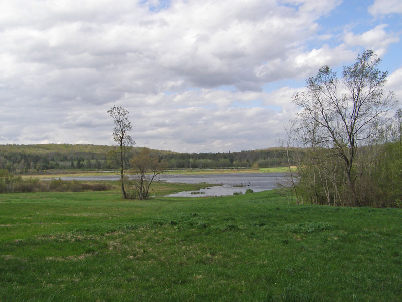
|
| Posted: 2009-10-24 00:00:00 Updated: |